

KATHMANDU: The ground in the Bhotekoshi area had been gradually shifting for months before the massive landslide on August 26, a preliminary satellite-based analysis has found.
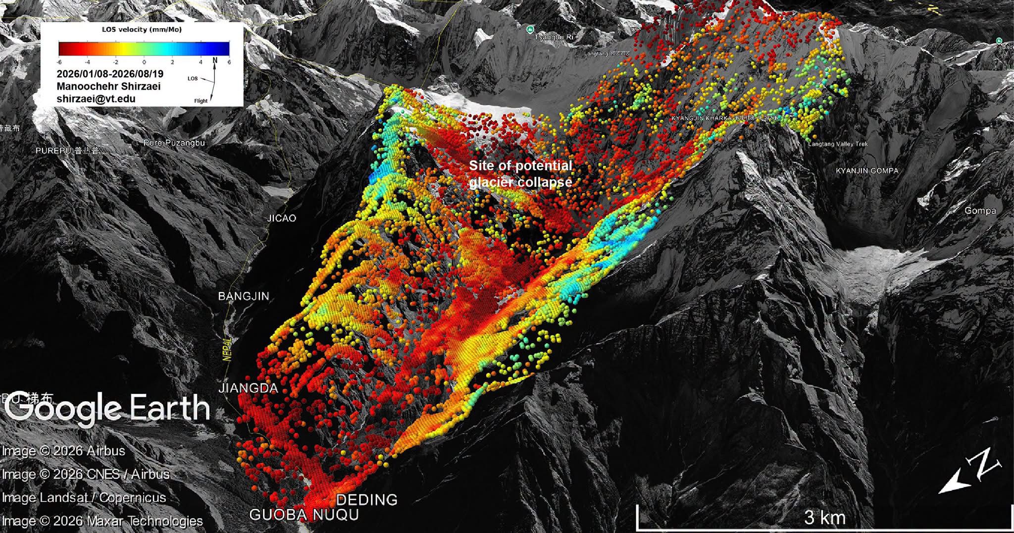
The analysis by Manoochehr Shirzaei, a professor at Virginia Tech, examined radar observations from Sentinel-1 satellites between January 8 and August 19, 2026. The data indicate that the ground in the affected area was moving downward at a rate of about 10 millimetres per month.
The analysis suggests that the ground continued to deform gradually until at least seven days before the landslide. The prolonged movement may indicate that the slope had been becoming increasingly unstable before a section eventually detached and collapsed. However, the finding remains preliminary and requires further scientific and field-based verification.
Radar satellites are particularly useful for monitoring ground movement in Nepal because their observations are not obstructed by clouds. During the monsoon, much of Nepal’s mountainous terrain is covered by clouds, making it difficult for conventional optical satellites to detect subtle changes on the ground. Radar technology can monitor surface deformation even through cloud cover.
The findings highlight the potential for using radar satellite data to identify areas experiencing gradual ground movement and assess landslide risks in Nepal.
Integrating long-term radar observations with rainfall, weather, glacial conditions, geological data and ground-based measurements could help identify unstable slopes and strengthen early-warning and disaster preparedness systems.
However, ground deformation alone cannot predict exactly when a landslide will occur. Further research is needed to determine which patterns and levels of movement indicate an imminent failure.