



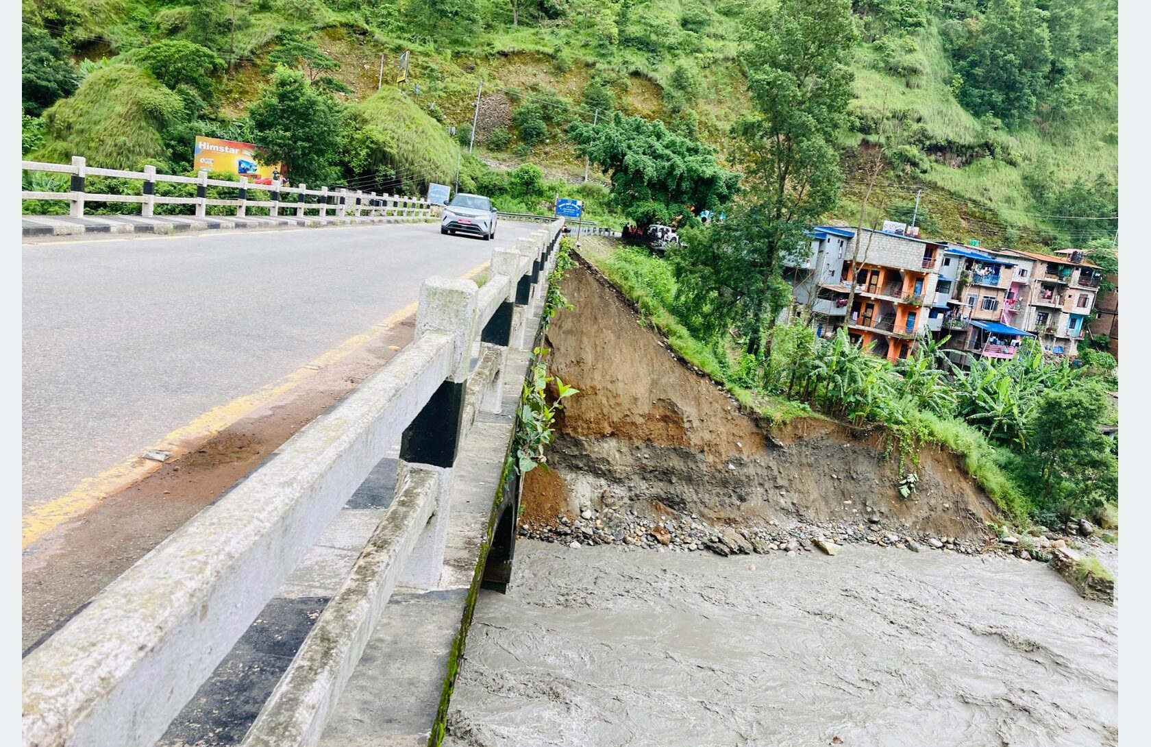
BAGLUNG: The Maldhunga Bridge, a key entry point to Baglung, is facing growing danger as erosion by the Kaligandaki River continues to weaken its structure.
Officials say the situation has become more serious after repeated landslides occurred near the bridge foundation on the mountain-side section. The river erosion has affected the motorable bridge connecting Baglung and Parbat districts, raising concerns about the safety of traffic movement.
The bridge, constructed about 30 years ago, has seen erosion around the foundation of its main mountain-side pillar due to the swollen river caused by continuous rainfall. Since last Thursday, the river level has remained high, and soil has started collapsing from the foundation area.
Chief Engineer Hari Subedi of the Road Division Office said that a preliminary inspection has been carried out and the matter has been referred to the Division Road Office in Pokhara for a detailed technical evaluation. He said repair work cannot begin immediately and will start only after the water level drops and the extent of the damage is assessed.
The bridge, located on the Pokhara–Baglung section of the Mid-Hill Highway, had previously been considered vulnerable because of changes in the river’s course and ongoing erosion. Chief Superintendent of Police Phadindra Prasai said passenger and freight vehicles are currently being allowed to cross with caution after a protective wall built to safeguard the bridge foundation collapsed.
The Road Division Office has also raised concerns over continued extraction of riverbed materials around the bridge. Although the law prohibits excavation within 500 meters upstream and one kilometer downstream of a bridge, officials say such activities have continued, increasing the risk to both the bridge and the nearby Maldhunga settlement.
Engineer Amar Adhikari of the Division Road Office, Pokhara, said the river’s current flow is too strong to begin immediate repairs. He added that conservation and repair work will be undertaken after a comprehensive technical assessment and once the water level recedes.