

KATHMANDU: The source of the devastating Bhotekoshi flood that swept through three districts of Nepal has been traced to a massive collapse of ice and rock in the high Himalayas, officials and researchers said.
The collapse occurred around 20 kilometres north of Rasuwagadhi, where a large mass of ice and snow reportedly fell from an elevation of around 5,000 metres, triggering a chain of events that ultimately produced the catastrophic flood in Nepal.
Nepali and Chinese researchers began investigating the source after the disaster. China has dispatched research officials for field observations, while flood experts from Nepal have also been studying the event.
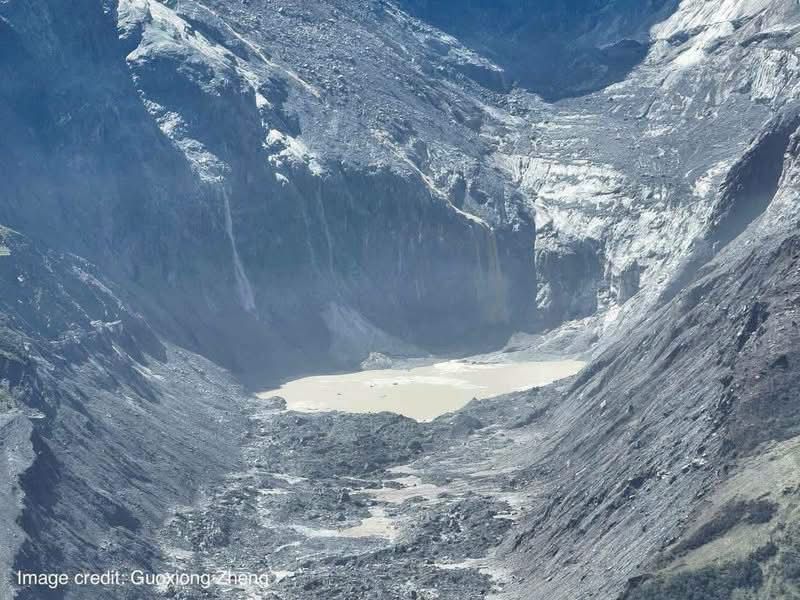
Flood expert Dinakar Kayastha said a large block of ice from a mountain north of Langtang Lirung appears to have fallen nearly two kilometres into a lake at around 3,000 metres.
“The ice and snow mass suddenly struck the lake with enormous force, carrying material into another lake below. That lake then suddenly burst, sending a massive flood down the Lhende Khola,” Kayastha said.
The flood from the Lhende Khola eventually merged with the Bhotekoshi River, causing widespread destruction across Rasuwa, Nuwakot and Dhading.
By the time of reporting, nearly 700 bodies had been recovered, according to Nepal’s National Disaster Risk Reduction and Management Authority. More than 2,000 people remain missing, while roads, settlements and riverbank infrastructure have been swept away.
Major commercial centres and settlements including Timure, Syaphrubesi, Mailung, Betrawati, Devighat, Tupche and Trishuli have suffered extensive damage. Finance Minister Swarnim Wagle has estimated the total damage at more than Rs 600 billion.
The European Union has reported that 240 houses in Syaphrubesi were completely destroyed. The Copernicus Emergency Management Service is also analysing satellite and other visual data to assess damage to houses and infrastructure along the river corridor.
Chinese state news agency Xinhua reported that its journalists visited the suspected source area and found deposits of mud exceeding 1.5 metres in some of the worst-affected locations.
Kang Shichang, director of the Institute of Mountain Hazards and Environment under the Chinese Academy of Sciences, said part of a glacier at an elevation of approximately 5,200–5,400 metres above sea level fractured and rapidly descended, carrying a huge volume of rock and mud with it.
Yao Tandong, an academician at the Chinese Academy of Sciences, said the massive flow of ice, mud and debris gained additional material as it moved rapidly down the mountain before entering the river.
“The destructive force increased as the flow moved downhill, bringing additional risks with it,” Yao told Xinhua.
Guo Zhaocheng, an expert at China’s Ministry of Natural Resources, described the disaster as a high-altitude ice-and-rock collapse that rapidly transformed into a debris-laden flood.
Ouyang Zhaochun, a mountain-risk and engineering-safety expert at the Chinese Academy of Sciences, identified three major factors behind the scale of the disaster: the enormous volume of ice and rock that initially fell from a great height; the rapid transformation into a deep flow of ice, rock and mud; and the concentration of settlements and infrastructure on relatively flat land along the riverbanks.
Guo said it took only about seven minutes for the event to travel from the initial collapse to the Rasuwagadhi border point.
According to flood expert Kayastha, the Bhotekoshi River rose by as much as nine metres during the disaster.